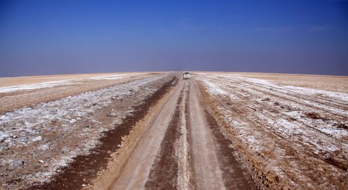
Information on Deserts and Types of Stargazing Groups

Deserts are vast and arid landscapes that covered approximately one-third of the Earth's surface. They are characterized by high temperatures, low precipitation, and sparse vegetation.


Despite harsh conditions, deserts are home to a diverse range of plants and animals that have adapted to survive in these challenging environments.

For this reason, deserts have become a popular destination for groups of observers who want to experience the unique beauty and wildlife of these areas.


Birdwatchers

One of the most popular groups of observers in deserts is birdwatchers. Deserts are home to various bird species that have adapted to survive in these challenging environments. Some common desert birds include predators such as eagles and falcons, as well as songbirds like larks and finches.

Birdwatching groups often travel to deserts during bird migration seasons, when large flocks of birds pass through these areas.


Sky and Star Observers

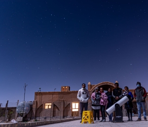
Another group of desert enthusiasts are star observers who, due to their remote locations away from urban environments and clear skies, provide the best opportunities for observing stars. The lack of light pollution in these areas enables a clear view of stars, planets, and other celestial bodies; many observatories have been built in desert regions due to the ideal conditions for astronomical observations.


گروه رصدگران ستاره های مهمان کهن سرای کیهان

"Astronomy Observers Group, esteemed guests of Kohan Saray Keyhan - April 2022"


Wildlife enthusiasts

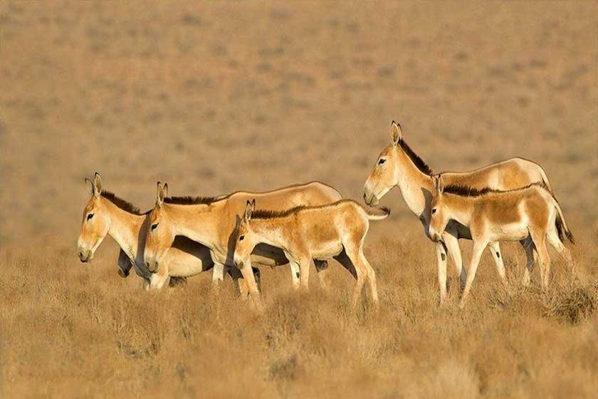
Wildlife enthusiasts are also drawn to deserts for the unique species of animals found in these types of regions. Desert animals such as camels, coyotes, snakes, jerboas, scorpions, and other extraordinary creatures that are exclusively found in these habitats; guests can take guided tours or hike through desert trails to see these animals in their natural habitats.


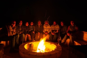
گروه رصد ستارگان در اقامتگاه بومگردی کهن سرای کیهان

"Astronomy Observers Group, esteemed guests of Kohan Saray Keyhan - july 2021"


Geologists and archaeologists

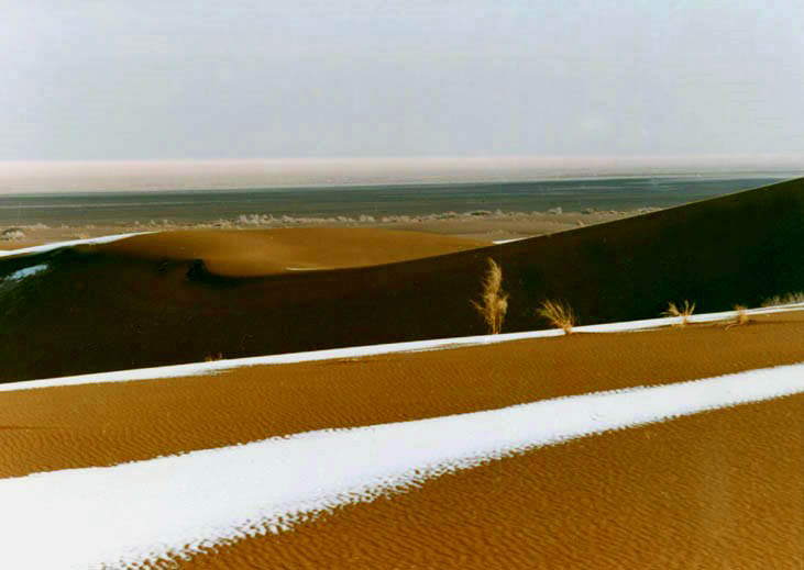
Finally, geologists and archaeologists also travel to desert areas for research purposes. Deserts present a collection of geological formations such as sand dunes, rocks, and valleys that provide insight into the Earth's history.

Due to the dry and moisture-free climate of these areas, fossils of prehistoric animals are found in these regions; the specific climatic conditions of these areas preserve fossils over very long periods of time.


Deserts are fascinating and unique environments that attract a diverse range of observers;

In these areas, there is something for everyone, from stargazers to wildlife enthusiasts or geologists.

We, at Kohan Sarai Keyhan ecotourism resort, due to our proximity to the National Desert Park, host several times a year the dear guests mentioned above.

Sannarad is a village the Garmsar district County.

which has many historical monuments

The Sanarad bathhouse is among the tourist attractions.

Kohan Saray Keyhan The Kohan saray - e -keyhan invites you to visit this fascinating place.

Enjoy our facilities by staying at this beautiful location.

In this video, we quickly and easily teach you how to cook Tehchin-e-Garmsari, a unique and delicious local dish of Garmasar County. This tasty and delightful food is a specialty of the region.
Share your thoughts on Tehchin-e-Garmsari and your experience of cooking it below this post.
To book accommodation in the city of Garmsar and the village of Sanarad, you can click here

Salt Tunnel of Garmsar

Garmsar is an attractive and fascinating city in Semnan Province, with a history dating back to ancient times, including the Parthian period,

and it boasts various attractions. In the vicinity of this city, there lies a vast desert,

Mount Damavand, and several other peaks, providing a unique spectacle

for visitors.

Kohan Sarai Keyhan ecotourism resort intends to discuss one of the amazing attractions

located in the city of Garmsar, which is considered a unique natural

wonder of the city and there are many tourists and nature lovers who travel to the city of Garmsar

to visit this area. To travel to the salt tunnel in Garmsar, it is necessary to have information

about this tourist attraction, which we will discuss in detail below.


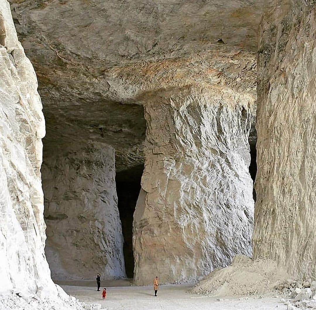
تونل نمکی گرمسار


Introduction to the Garmsar Salt Tunnel

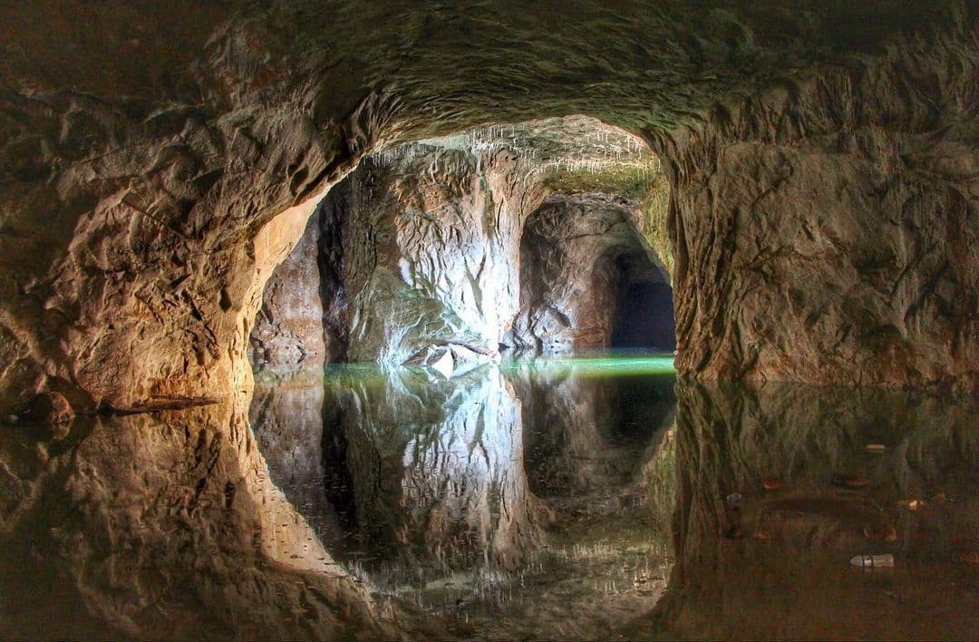
The Garmsar Salt Tunnel is one of the most popular tourist attractions in Garmsar county

Based on what was mentioned above, the salt tunnel in Garmsar is one of the most astonishing attractions

that is considered an excellent choice for nature enthusiasts and tourists. Every year, many travelers

visit Semnan Province and the city of Garmsar to explore this area.


The city of Garmsar is bordered by Mount Damavand to the north, Varamin to the west, Aradan to the east,

and the Central Desert of Iran to the south. It boasts a high diversity in ecotourism, making it an appealing destination for travelers.


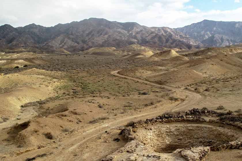
Among the attractions you can witness in this area are hills whose soil closely resembles that of the planet Mars.

People from all over the world travel to this area to visit them. However, the salt tunnel in Garmsar

is an attraction that we want to talk about in this article, and it is one of the best places.

You can visit this area to see it. The salt tunnel in Garmsar is the largest salt mine and tunnel

in the Middle East and currently accommodates 40 salt tunnels within itself.

It should be noted that this cave plays a major role in salt extraction in Iran.

چشمه نمک گرمسار

Extraction of salt from the salt tunnel

Salt has been extracted from the mines in this county for almost ten years.

One of these mines, which is in the form of a mountain and has been converted into a

cave-like structure due to salt extraction from it.

Typically, for tunnel construction on roads, a specific template

is used to ensure the strength, durability, and safety of the tunnel. However, for excavating

the entrance and forming this salt cave, only the vertical distance from the surface and width have been considered,

This means that the height will be approximately twice the width, forming a rectangular shape.

At the entrance of the salt tunnel in Garmsar, the walls are dark and grayish, and the deeper you go,

the brighter and shinier it becomes inside this cave.

Approaching the brighter levels indicates that the time of excavation of that point of the cave

is closer to the present.

You will see walls made of salt, with stalactites of salt

hanging throughout it, giving a special beauty to the salt tunnel in Garmsar.

غار نمکی گرمسار

About 15 kilometers west of Garmsar and 90 kilometers from Tehran, on the roads to Eivanakei and Garmsar,

there are nearly 27 salt mines. When passing through Eivanaki, you will see some of these

hills and landscapes. 500 meters before the exit of the Qom-Garmsar freeway,

there is an exit on the right side of the road. To reach the unique Kohdasht Kohan Mine, you must

enter this exit.

سنگ نمک

Visual Splendors of the Salt Tunnel in Garmsar

When visiting this fascinating and scenic area, one of the most beautiful sights that catches your eye

is the ravines washed by rain. Additionally, along the way

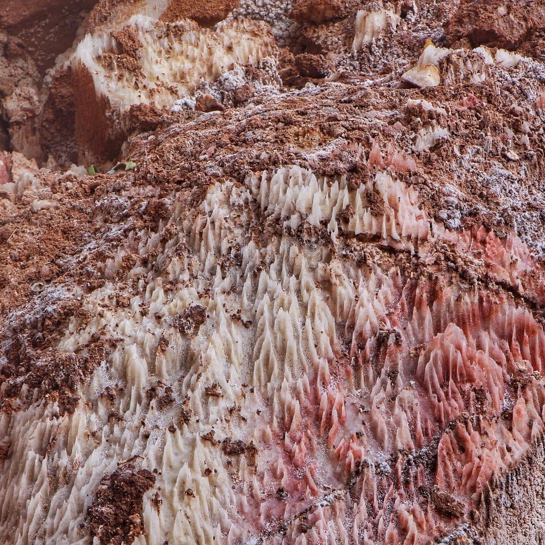
"Salt crystals" also manifest themselves in floral, oval,

layered shapes with various colors. This color diversity is due to the presence of elements and impurities

in the composition of salt.


Inside the salt mine, as we mentioned, it is dark and slippery, so it is better

to observe extreme caution and always have a small flashlight with you.


Kohan saraye Keyhan Traditional Eco-lodge offers tourism services, accommodation, and more,

welcoming dear travelers and guests.


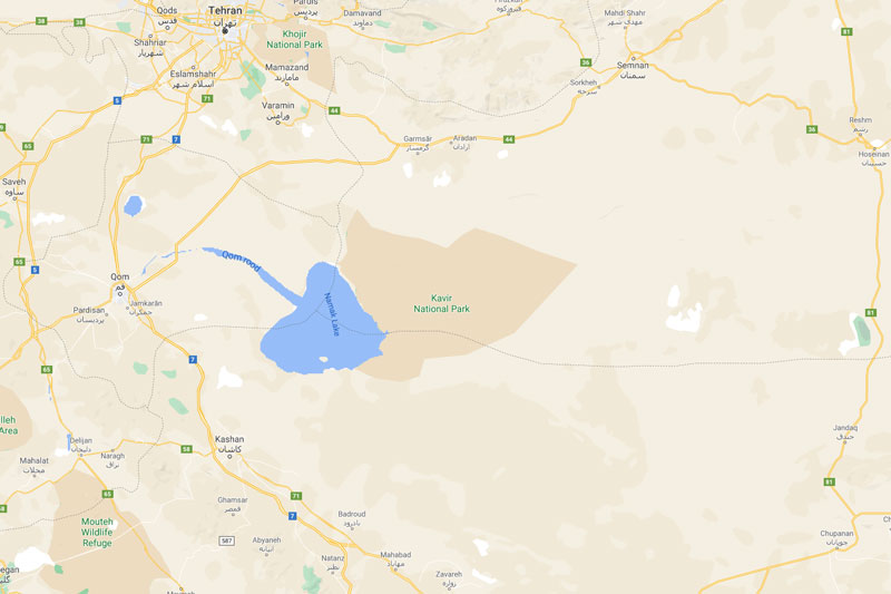
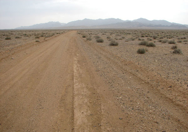
The Kavir National Park is one of Iran's largest and oldest protected areas, most of which is located in the Garmsar district Semnan Province

And small sections are also located in Tehran, Qom, and Isfahan provinces.


پارک ملی کویر


the Desert region is one of the few points on the Earth's surface that should be protected as a global reserve.

Since 1964, the Kavir region has been under the "Iranian Hunting Center" — which later became the Environmental Protection Organization — and since 1976

...it was elevated to the higher protection status of a National Park. In 1978, with the reduction of some areas in the north and the addition of areas in the south،

its area reached 670,000 square kilometers, and in 1982, considering the economic, social, and available resources

and protective capabilities, it was divided into two parts: a national park covering an area of 420,000 hectares, including the regions of Siyah Kuh, Nakhjir, and Sefid Ab

and all adjacent hills and plains, and the protected area of the Kavir covering 250,000 hectares

It was divided into the plains of Makoush, Siah Pardeh, Pardeh Zard, and the elevations of Davazdah Emam and Nareh Khar Kooh, and was placed under the management of

the General Department of Environmental Protection of Semnan Province.


Geographical location

موقعیت جغرافیایی


access routes

راه های دسترسی


The entry routes to Kavir National Park are:

Route 1: The most suitable entry route to the area is via the asphalt road from Varamin, Pishva, continuing to one kilometer from the Abardezh railway station

and from the route of the gravel road from Qaleh Boland, Asgharabad, Hasar Goli to the Mobarakiyeh Conservation Base, it reaches and enters the Kavir National Park.


Second Route: Starting from Garmsar County towards the south and after passing through the paved road, it reaches the environmental protection area of ​​Siah Kooh.


Third Route: It starts from Marnjab Caravanserai in the north of Bandar Rig Desert and south of Aran and Bidgol Salt Lake. After traveling approximately

50 kilometers, it reaches the environmental protection area of Sefidab.


Fourth Route: From the southern side of the Kavir National Park, through Kashan, Aran, Marnjab, to the Sefidab environmental protection station,

and just before Band-e Ali Khan, it reaches the seasonal environmental protection station of Band-e Ali Khan via the Varamin, Javad Abad, and CharmShahr roads.


Other Routes: There are other ways to enter the area, but crossing them without a guide can be very dangerous.

To prevent any potential unpleasant incidents, it is necessary to obtain information and permission

from the Semnan Province Department of Environment and coordinate with the affiliated units located in the area before embarking on any travel plans.


Climate

The desert park is home to springs and rivers. Among them are the White Water Spring near the White Water Reserve,

the Saltwater Cascade Spring near Malekabad, and the Black Mountain Spring near the Black Mountain environment protection.


چشمه سفید آب


When traveling to this desert, make sure to have sufficient water, a suitable desert vehicle, a spare tire, enough fuel, a first aid kit,

sunscreen, a hat, and sunglasses. It is also recommended to use tours specifically organized for this park to benefit from facilities

tours specifically organized for this park to benefit from facilities such as caravanserais like Dirgachin Caravanserai,

Bahram Palace, Martian Hills, and other areas and spaces of the Desert National Park.


Animal species in the desert national park

گونه های جانوری


In total, 34 mammal species, 155 bird species, and 34 reptile species have been identified in this area.

The Persian leopard, Iranian cheetah, wolf, striped hyena, sand cat, red fox, sand fox, caracal, wild goat, mouflon,

jackal, and black-eared wheatear are among the prominent mammals of this area.


The Kavir National Park was once one of the best habitats for the Iranian goitered gazelle, but its population has now dwindled.

In the late years of the 1350s decade, it was estimated that around 800 Persian goitered gazelles inhabited the Kavir National Park،

But after years, it is still unbelievable that the population of 800 goitered gazelles in Kavir National Park

was completely wiped out in just 5 years! The last gazelles in Kavir National Park were a herd of 17 individuals in the Chah-e Qarqareh area in the eastern part of the park.

The last time they were seen was in 1363 (1984), and since then, there have been no reports of observing goitered gazelles in this area.


If the goitered gazelle species has not become extinct, it is on the verge of extinction, but the population of the Persian gazelle (a type of gazelle smaller and more delicate than the goitered gazelle)

in this area is likely the largest in all of Iran.


Kohan Saraye Keyhan eco-lodge provides eco-tourism services, accommodations, and more, welcoming dear travelers and guests.


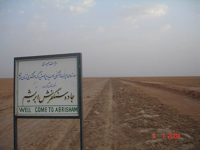
در طول جاده سنگفرش در بخش های مشرف به آبراهه های باریک،

برای جلوگیری از نفـوذ آب و  تخـریب جـاده  طـرفین آن سکو سازی شده است.

در جبهه شمالی جاده با ایجاد آب گذر ممتد جهت هدایت آب باران و سیلابها که از بخش شمالی سرازیر می گردد،

از دیگر اقداماتی بوده است که از تخریب و آب گرفتگی سطح جاده جلوگیری به عمل آورده اند.

آب گذر ممتد شمالی جاده به گدارها و مسیل ها و سپس وارد رودخانه کویری می گردد.

جاده سنگفرش

۲ پل مهم در مسیر جاده سنگفرش

دوپل مهم در مسیر جاده سنگ فرش عبارتند از پل سفیـد و پل سیـاه بر روی رودخانه شور(لات جمعه)

و پل سفید بر روی رودخانه گلو احداث گردیده بود. پل رودخانه سفید دارای هفت دهنه بوده و بخش های

مانده از ان نشانگر عظمت و ساخت و ساز معماری کویری در آن زمان بوده است.

در بعضی از این طاق چشمه ها ی محلی برای اطراق کاروانیان منظور گردیده بود، طاق چشمه ها

و بخشهای مانده پل براثر مرور زمان و متروکه شدن جاده و عدم استفاده، تخریب و ویران شده است.


تا دو دهه پیش آبهای ناشی از سیلابهای بهاری از زیر بقایای دهانه های پل. پس از سالیان دراز

جریان داشته است. برنمای داخلی پوش یکی از طاق چشمه ها آثار کاربندی آجری به چشم می خورد

که تا پاکار قوس آن از گل و لای انباشته بود. ساخت چنین جاده ها و پلهایی در دوره صفویه

علاوه برمقاصد تجاری و نظامی، به منظور آسایش و تردد کاروانیان در کوتاه ترین مسیر متعارف مورد توجه بوده است.


جاده سنگفرش


استفاده فعلی از جاده سنگ فرش

تا چند دهه اخیر، قبل از اعلان مراتع سیاه کوه به عنوان منطقه حفاظت شده و امن (پارک ملی کویر)

دامداران و عشایر the Garmsar district، گله های خود را از طریق این جاده به مراتع مذکور گسیل میداشتند.

این راه از جنوب گرمسار، پس از عبور از روستای ساروزن بالا و پایین، کهک یا سنرد و دکل علی آباد

در جهت جنوب غرب به مجموعه تاریخی سیاه کوه منتهی میگردد.

درحال حاضر نیز تردد از این جاده تاریخی به صورت موردی انجام می گیرد و با توجه به مدیریت پارک ملی کویر

و مجموعه تاریخی سیاه کوه توسط سازمانهای محیط زیست و میراث فرهنگی استان تهران و صدور مجوز بازدید

از این مناطق توسط ادارات استان تهران، ورود به منطقه از طریق جاده ورامین، پیشوا، امامزاده جعفر،

جاده شوسه کنار راه آهن و آبادیهای عسگر آباد و حصار گلی انجام می گیرد.


معدن نمک گرمسار

معدن نمک گرمسار یکی از شگفت انگیزترین جاذبه هایی است که برای طبیعت دوستان و گردشگران گزینه ای عالی محسوب

می شود و سالانه مسافران زیادی برای بازدید از این منطقه به استان سمنان و شهر the Garmsar district سفر می کنند.

تونل نمکی در گرمسار بزرگترین معدن و تونل نمکی در منطقه خاورمیانه است و در حال حاضر ۴۰ تونل نمک را در خود جای داده است.

It should be noted that this cave plays a major role in salt extraction in Iran.

این معدن که در نوع خود در بین معادن نمک منطقه بی نظیر است در داخل تونل های آن

۶ ستون بزرگ نمک به ارتفاع ۱۲ متر و به شعاع تقریبی ۱۰ در ۲۰ متر جهت جلوگیری از ریزش تونل پیش بینی شده است

که با ورود به داخل تونل چشم هر بیننده ای را به خود جلب می کند.


زمانی که به بازدید از این منطقه ی جذاب و دیدنی می روید، زیباترین منظره ای که به چشمانتان برخورد می کند شیارهایی است

که توسط باران شستشو می شود. همچنین در طول مسیر کریستال های نمک” هم خود نمایی می کنند

که به شکل های گل کلمی، تخم مرغی، لایه ای، با رنگ های متنوع دیده می شوند. این تنوع رنگ به دلیل وجود عناصر و ناخالصی ها در ترکیب نمک است.


درجه خلوص نمک بسیاری از این معادن بالای ۹۸ درصد است. معدن کوهدشت کهن و معدن سالار از زیباترین معادن نمک این منطقه است.

قندیل‌های زیبای نمکی در این معادن هرساله گردشگران بسیاری را جذب می‌کند.

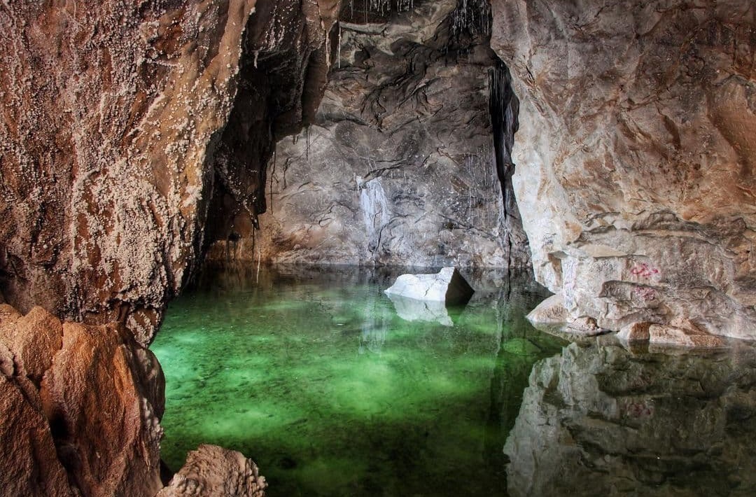
Garmsar Salt Cave

غار نمکی بخشی از معادن نمک است که برکه کوچکی وسطش جا خوش کرده. برکه پر از آب نمک است و خنکی و سکوت غار، برای تمدد اعصاب و آرامش معجره می‌کند.

غار نمکی


اقامتگاه گردشگری، توریستی و بومگردی Kohan Saray Keyhan از شما دعوت می کند تا ضمن سیاحت و گردش در شهر گرمسار و جاذبه های توریستی دیگر آن شامل مجموعه سیاهکوه ، خانه تاریخی باقری ها ، جاده سنگ فرش و کویر ریگ جن ، میهمان ما جهت سرو غذا و اقامت در روستای باستانی گردشگری سنرد باشید.

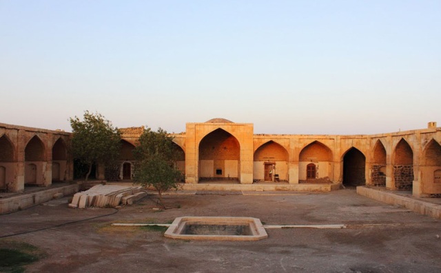
تاریخچه کاروانسرای قصر بهرام

در اوایل سال ۱۳۳۷ مطلبی در روزنامه‌های ایران تحت عنوان کشف قصر بهرام گور در نزدیکی دریاچه‌ی نمک کویر مرکزی منتشر شد.

انتشار این خبر به مانند کشف بنایی ناشناخته و پیدا شدن بنایی دیگر از ساسانیان بازتاب یافت. اما راستش بنا  تا آن‌ موقع خیلی

ناشناخته نبود و  تعلق آن به دوره‌ی ساسانی نیز قطعی به نظر نمی‌رسید. اگر از همان سال ۱۳۳۷ به عقب برویم، خواهیم دید که

ایران‌‌شناسان برجسته به آن توجه نشان داده‌اند. مرحوم منوچهر ستوده (۱۲۹۲ – ۱۳۹۵) آنچنان به منطقه اشراف داشت که راهنمای

علاقه‌مندان می‌شد. مرحوم ایرج افشار (۱۳۰۴ – ۱۳۸۹) نیز در سال ۱۳۳۴ از این بنا عکس‌هایی برداشته بود. در سال ۱۳۱۲

آلفونس گابریل (Alfons Gabriel) اتریشی به همراه همسرش از آن دیدن کرده بود. بوهزه‌ (F. A. Buhse)، گیاه‌شناس روسی،

در سال ۱۸۴۹ (۱۲۲۸ خورشیدی) از آن عبور کرد. حتی این کاروانسرا در گزارش پیترو دلاواله (Pietro della Valle) و توماس هربرت

(Thomas Herbert)، که هر دو در قرن هفدهم میلادی می‌زیستند، آمده است. کاروانسرای قصر بهرام که با نام‌های کاروانسرای

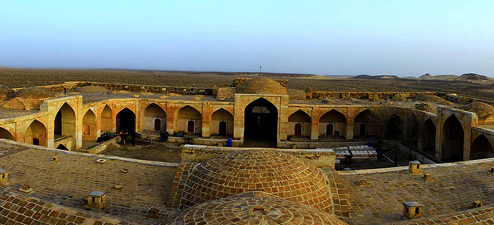
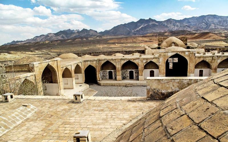
شاه عباسی و رباط سیاه‌کوه نیز شناخته شده است، از جاهای دیدنی گرمسار به شمار می‌‌رود و در استان سمنان، جنوب شهر

گرمسار و در محدوده‌ای که اکنون پارک ملی کویر نامیده می‌شود، قرار دارد.

قصر بهرام

نام گذاری قصر بهرام گور

به گفته‌ی ایرج افشار، این بنا از آن رو قصر بهرام گور نامیده شده که، به گفته‌ی شکارچیان و مسافران، بهرام پنجم ساسانی

(۴۲۱ – ۴۳۸ میلادی) در همین نواحی شکار می‌کرد. روزی بهرام در باتلاق‌های نمکین اطراف سفیدآب و بیابان مخوف ریگ جن فرو رفت

و دیگر برنگشت. به گفته‌ی احمد مستوفی‌الممالک، که خاندانش در اینجا شکار می‌کردند، در این منطقه تا همین چند دهه‌ی پیش

گورخرهای زیادی وجود داشت. اما از اوایل دهه‌ی ۱۳۶۰ هیچ گورخری در این منطقه مشاهده نشده است. از طرف دیگر نکته‌ای که

باعث می‌شود این بنا را در آغاز کار نه کاروانسرا بلکه قصر یا ساختمان شکاری بدانیم فاصله‌ای است که بنا از نزدیک‌ترین چشمه‌ی آب

شیرین دارد. چشمه‌ی آب شیرین، که به چشمه‌ی شاهی نامور است، در فاصله‌ی هفت کیلومتری بنا قرار دارد که با کانال‌های سنگی

آبش به سمت سازه سرازیر می‌شده است. به نظر می‌رسد علت ساختن ساختمان در چنین فاصله‌ای از چشمه آن بوده که هیبت بنا

و سر و صدای احتمالی برخاسته از فعالیت‌های آن موجب فراری دادن حیوانات نشود و همچنان گورخر و حیوانات دیگر برای نوشیدن به حوالی این چشمه بیایند.


قصر بهرام

بنای کاروانسرا

علاوه بر آن، استفاده از سنگ به جای آجر نشانه‌ی دیگری از قدیمی‌تر بودن آن نسبت به کاروانسراهای آجری دوره‌ی صفوی است.

تمام این شواهد نشان می‌دهند که زمانی اینجا کاربری‌ای غیر از کاروانسرا داشته و کلنگش پیش از دوره‌ی صفوی خورده شده اما مدرک

و استدلالی که ما را مجاب کند که آن را متعلق به دوره‌ی ساسانی و بهرام گور بدانیم وجود ندارد. در نوشته‌های جغرافی‌دانان اسلامی

نیز هیچ کجا بحثی از سیاه‌کوه، که بنا در پای کوه‌های سیاهش قرار دارد، نشده است؛ زیرا در اوایل دوره‌ی اسلامی راه ارتباطی اصفهان

به خراسان از سمت نائین، طبس، ترشیز و نیشابور می‌گذشته و اصلاً اینجا در مسیرهای اصلی قرار نداشته است.


به نظر می‌رسد در زمان صفویه توجه خاصی به راه سیاه‌کوه به عنوان معبر ارتباطی بین اصفهان و خراسان و ری شده باشد. کاروانسرای

قصر بهرام در این زمان مهم‌ترین مرکز ارتباطی بین شرق و غرب حاشیه‌ی کویر شد؛ پایگاه ارتباطی و محل داد و ستد بازرگانان بود.

بازرگانان با کاروان‌های خود از سمت اصفهان و آران و بیدگل می‌آمدند و با گذشتن از کاروانسرای مرنجاب، در قصر بهرام اتراق می‌کردند.

در آنجا تصمیمات کلی برای مبادله‌ی کالا یا حمل کالا به شهرهای مورد نظر گرفته می‌شد.


دو ماخذ مهم جهت احیای بنا

توجه و احیای این بنا در دوره‌ی صفوی از دو مأخذ دریافت می‌شود: یکی کتاب تاریخ عالم آرای عباسی نوشته‌ی اسکندر بیگ ترکمان و

دیگری قدیمی‌ترین یادگاری‌ای که در بنا نوشته شده است. در کتاب تاریخ عالم آرای عباسی، نوشته شده که شاه عباس بزرگ

(۹۷۸ – ۱۰۳۸ قمری / ۱۵۷۱ – ۱۶۲۹ میلادی) با صرف هزینه‌ی ده هزار تومان رباط سیاه‌کوه و راه‌های اطرافش را ساخت. منظور از

رباط سیاه‌کوه در واقع همین بنایی است که به قصر بهرام گور معروف شده است. بر روی قشر گچی اتاق‌ها یادگاری‌هایی نوشته شده

که قدیمی‌ترینشان به سال ۱۰۰۱ قمری برمی‌گردد.

کاروانسرای قصر بهرام

نکته‌ی جالب آنکه بر روی سنگ‌های تراش نما و تخته‌سنگ‌های کانال سنگی، حروف لاتین Q, O, D, P, E, Y, W, M, S حک شده که ظاهراً

علائم سنگ‌تراشان هستند. شاید از روی آنها بتوان به این نتیجه رسید که احتمالاً پیمانکار یا بنا یک فرد خارجی بوده است.

در ساخت بنا از سنگ‌های روشن استفاده شده است؛ بنابراین می‌توان تصور کرد زمانی که کاروانسرا زنده بوده، در دل منطقه‌ای که سنگ‌

کوه‌هایش همه سیاه بوده‌اند، چه جلوه‌ای داشته است.


قصر بهرام

پلان بنا از نوع متقارن و مربع مستطیل به ابعاد ۷۴ در ۶۵ است. دو در دارد: یکی جنوبی و دیگری شمالی. دو سکو و دو اتاق هم در دو طرف

دروازه‌ی ورودی وجود دارد. داخل آن حیاط بزرگی است که دورتادور آن را اتاق‌های کوچک فراگرفته است. در بدنه‌ی غربی حیاط یک تالار با

شاه‌نشین و طاقچه‌هایی در اطراف و ایوانی در جلو ساخته شده و در زیر تالار زیرزمین بزرگی است. در پشت ساختمان‌های داخل حیاط هم

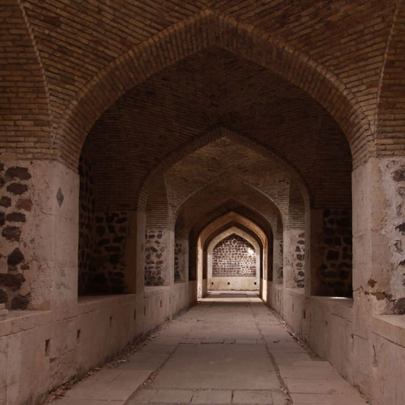
طویله‌های سراسری با آخورهای متعدد و کنار هر آخور سکویی برای استراحت چهارپادار و اجاقی برای طبخ بوده است. در چهار گوشه

و میان اضلاع شرقی و غربی نیز شش برج دفاعی که دارای تیرکش هستند.


تالار کاروانسرای قصر بهرام


اهمیت جغرافیایی کاروانسرا قصر بهرام

اگر به موقعیت جغرافیایی و راه‌ها نگاه کنیم دور نمی‌نماید که کاروانسرا جایگاه مهمی را اتخاذ کند: کاروانسرا در محلی واقع شده که از آن

یک مسیر از سمت کویر به the Garmsar district و فیروزکوه می‌رفت و از یک مسیر به ورامین و تهران. در واقع قبل از اینکه جاده‌ی تهران-قم راه‌اندازی

شود، این مسیر کوتاه‌ترین راه بین تهران و کاشان بود و حکم شاهراه را داشت.

همان‌طور که اشاره شد، در دوره‌های زمانی مختلف اشاراتی از کاروانسرا و راهی که در آن قرار دارد در دست است. آنچه مسلم است

آن است که از دوره‌ی پهلوی، و شاید قدری قبل از آن، این مسیر و کاروانسرا از رونق افتاد. ایرج افشار در سال ۳۷ می‌نویسد کاروانسرا

چهل‌سالی است که متروک شده و گابریل نیز در گزارشش که در سال ۱۳۱۲ نوشته می‌گوید زمانی که او از جاده می‌گذشته، از

کاروانسرا استفاده‌ای نمی‌شده است.

این ساختمان اکنون به عنوان مهمان‌سرای پاسگاه شکاربانی در پارک ملی کویر مورد بهره‌برداری قرار می‌گیرد.

راه اصلی به منطقه‌ی پارک ملی کویر از تهران از طریق جاده‌ی آسفالته‌ی ورامین-پیشوا (امامزاده جعفر) است. جاده‌ی شوسه‌ی کنار

راه‌آهن به مبارکیه می‌رسد. جاده از حاشیه‌ی منطقه‌ی مبارکیه ادامه پیدا می‌کند و بعد از آن وارد منطقه می‌شود.

از کاشان هم باید به آران و بیدگل رفت و از آنجا به مرنجاب. سپس از راه کویر کهک شهرستان گرمسار هم می‌شود وارد پارک ملی کویر شد.

کاروانسرای قصر بهرام در ۱۳ اردیبهشت ۱۳۵۴ با شماره ۱۰۵۴ به جمع آثار ملی پیوست و بهترین نقطه در پارک ملی کویر از منظر گسترش

اکوتوریسم شناخته شده است.